Getaway ride in Epidauros: stunning views and “a descent in Hades” on top of the Methana volcano
Kammeni Hora… The Burned Land. Words that sound like an incantation. I saw the reddish lava dome of Kammeni Hora for the first time in October 2021. From a distance. My company of the time didn’t feel like climbing on top of the volcano. The path, in its beginnings, looked difficult in her eyes. Steep slope, many loose stones on the bigger rocks. In January 2022, during my second try, I had other company. Agronomist and photographer Vassilis Petris admitted the lava dome could be a dangerous hike. It is in an area of volcanic activity and earthquakes. We still wanted to give it a go. We had seen pictures of the views from the top of the mountain. Of it’s mysterious, cavish formation of rocks, too. Off we went. Despite of a dizzy morning. We didn’t regret.
*** *** ***
5th January 2022, Ligourio – Methana
Text and photos: Horsemail.fi / Margit Ticklen & Vassilis Petris. No reproduction allowed.
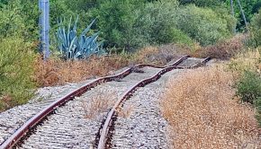
Methana is actually not an island. It is a peninsula. And it is not exactly a part of Epidauros. To reach it from Ligourio, the central village of Epidauros, one has to undertake a 45 minute car trip.
The drive is surely not a minus. There are stunning views from the road all the way from Ligourio down to Palaia Epidauros and the seashore, then further along the coastal line until the lake of Psifta.
Lake Psifta is a natural reserve and a good point to stop before “the final attack” to get to the volcano. It is situated right before the only 100 metres wide isthmus connecting Methana to the mainland Peloponnese. There is a wide variety of big birds to be observed: flamingos, swans, common cranes, herons.
While in Psifta we already distinguished the Kammeni Hora. It’s specific colour coming from the big amount of silicon dioxide.
“Wooh. It looks strange. Not at all like Santorini where the stone is black”, Petris stated.
Yes, Santorini… it is an island born from volcanic activity. The peninsula of Methana, also, was once an island created by volcanic activity. The correct way to write about Methana would, therefore, be to write about the volcano called Methana. That’s how it is: the peninsula is one big volcano with about 30 different eruption points.


An eruption is still possible
One of the eruption points of Methana is Kammeni Hora. It is not very high: 410 metres whereas the highest point of Methana is 740 metres above the sea level.
Kammeni Hora is a special place. It is the place where the lava last time flowed from inside the ground. This happened in 270 – 230 BC.
The kinky thing about Kammeni Hora is the researchers underline the volcanic activity in the area has not stopped. There are still not-with-ground-covered eruption points under the sea between Kammeni Hora and the nearby island of Agistri. Some of them may have been created as late as 1700 AD.
This is possible because Methana is cut by many tectonic faults.
“It only needs new magma to add to the already existing magma chambers under Methana, and there are mixing processes that allow [sulfur dioxide] gas to free up.
If there are still tectonic processes like earthquakes a new volcanic eruption is possible at any time.”*
Having this in mind, while we finally stood in front of the slopes of the lava dome, it was no wonder we looked at it with respect. It didn’t seem to be the common cardamom bread beside one’s morning coffee.
We didn ‘t know how right our thoughts were. We didn’t know how the climb to the top of Kammeni Hora would mark us.


Admire, drive, climb
Let’s go back to Ligourio, the starting point of our trip, for a moment.
Like said, there is a distance of 10 kilometers between Ligourio and the seashore of Palaia Epidauros. Sounds like a long one? Yep. Because even many of yhe inhabitants of Ligourio ignore both Palaia Epidauros and Methana peninsula can be admired from the shores of their village.
One just has to follow the sandy/concrete road from the cimetery (kimitirio in greek) towards the east. Very soon, when you have passed the last building on your right, a view of the sea and Methana opens up on your right, between the olive trees.
For me the first time I discovered the view of the Saronic Gulf from literally from behind my home was something of a sacred feeling. I could see the wild nature of the peninsula. I imagined how it would feel like to drive the last kilometres to the Kammeni Hora. The narrow road that is all curves.
More: it’s curves, curves – and then some more curves. And big stones fallen on the road. Fallen down the slopes of the mountains during the rainy winter period of the year.
When driving the road with Petris I checked the time needed for the trip. A bit less than one hour from Ligourio, without counting the stop at Psifta.
The whole half-day trip, with climb to the top of the volcano, is largely faisable in four hours.


In between the sacred trees
When we arrived to the village of Kammeni Hora we first stopped to “talk” with some goats by the street. Second stop was by a tiny church which had around it an as well tiny cimetery and a handful of houses.
The houses were mostly empty. This fact and the contrast between the mountain slopes on the southern and northern sides of the village it made us silent. In the south the slope was green. In the north it was red. With no vegetation except some bushes.
That’s where we were going to. To the Kammeni Hora – the burned land!
I asked Petris about his thoughts.
“A lonely, wild place. And still not far away from the civilization. It looks interesting for pictures”, Petris stated.
His words sounded good. I remembered to have read about the three main subjects of all forms of art. One of them was loneliness*.
The path to the top of the lava dome, to its so called crater, starts from the eastern side of the volcano. There one can also find the only pine trees along the path.
The greek pines always give one a special feeling. They are trees of joy. In ancient Greece pine tree was sacred to Dionysos, the God of wine and viticulture – of having fun.

A look at Agistri, Aegina and Athens
Petris attacked the path first. He had hardly time to warn me about the big, loose stones on which we had to step. They came quickly in front of us – and as quickly they were not there anymore. The “difficulties” of climbing Kammeni Hora were over in less than 50 metres.
Understanding this I felt sorry for my company in October 2021. She certainly could have accomplished the path. After the very beginnings the climb is of a “family friendly” nature. It took us all together only about 20 minutes.
Even more sorry for my friend I felt while we were close to the top of the volcano. The view from the path (monopati in greek) towards Agistri and Aegina islands and Athens was breathtaking. We stopped several times to take pictures of it.
The beauty of the view made us to start a discussion about death and the aftermath of it on the other hand in Ancient Greece and on the other in our modern European – Christian! – societies.
“In Ancient times the Greeks were very much concerned about their value to their own society. It was important to be useful for it. So useful that one’s name would be remembered for a long time after one’s death”, Petris reminded.
Being useful to the society meant also a place in “paradise”.
“Paradise was not for everybody who had lived a peaceful and nice life. It was for those who had served their society in a special way”, Petris underlined.
This restriction didn’t mean that the rest of the people had it very difficult after their death.
“They went to the world of Hades. It was not a place of torture and burning like we Christians think. It was a place of feeling nothing, being nothing. Loosing your conciousness. Even for those who had committed severe crimes”, Petris explained.


“On the Moon”
I had nothing to disagree with Petris on this subject. Actually, when looking the sea between Kammeni Hora and Agistri, I felt like giving the Ancient Greeks a big “like”.
“Two years ago I listened to a speech givcen by Laura Kolbe in Helsinki, Finland. Kolbe is a professor of European history at the university of Helsinki. She pointed out that being peaceful and satisfied in life is for us humans a result of feeling useful for our own society. Because if we are useful to it we can be pretty sure it will keep us safe”, I told Petris.
And I added:
“Means I can understand what you’re telling. Giving priority to Paradise for those having done something to promote their society.”
While talking we had attained the crater. It is approximately 50 metres by 100 metres by size. Seen from inside of it it looks more or less like a big flat area with stones fallen from the sky.
“We’re on the Moon now”, Petris laughed while he helped me to climb on top of one of the 2-3 metres high lava stones in the crater.
I wanted to have some pictures in which the crater would be seen in a different angle. I failed. The weather conditions were difficult: there were grey clouds too close to us. One couldn’t enjoy well enough the reddish colour of the lava stones.
So: if you would like to see the size and shape of the crater of Kammeni Hora… please use Google Earth. From the air you will get an idea how it really looks like.

At the other side: the Sunken City
What comes to our climb to the top of Kammeni Hora it had not yet come to it’s final goal.
In front of us, on our left, there were huge, grey rocks like stairs leading even higher than the crater. We continued by them.
At this phase of the climb good shoes were needed. It was not difficult to get from one rock to another but slipping… I didin’t want to think about it. All around us there were only rocks with sharp ends and wide shallow areas in between them.
When getting upwards we saw another side of the peninsula of Methana. Behind the water there was not anymore Athens. There was Palaia Epidauros.
“Did you know that there are ruins of houses from the ancient Roman times under the water in Palaia Epidauros”, Petris asked me.
I hesitated to answer. I had heard about the Sunken City but I had thought the ruins were from an earlier era.
“There was a tsunami that had been created by the volcanic activity and had left a part of the city of Palaia Epidauros under its’ flood…”, I murmured.
Petris was not sure about the tsunami.
“We better ask someone who knows more about it. Maybe someone who can take us to see the Sunken city by kayaks”, Petris suggested.

In the torch light
After some 30 metres of climbing from one big rock to another we passed a small, cavish formation. For a while I thought that was the goal we had come for. But luckily no, it wasn’t. We made 20 meters more and saw a stone wall. On it a flash pointing downwords and the word “VOLCANO”.
Strange as it was we of course went where the sign showed. The entrance to the cave (“volcano”) was not wide nor very tall. behind it we saw only darkness. We didn’t have other light with us than the one we could get from our mobiles.
“I am not sure I feel like going in”, Petris said.
This meant I was the first to step in. I was not to leave the cave unexplored after having finally had the opportunity to climb the Kammeni Hora.
And surprise: inside the cave there was some light. The roof was partly made of big stones and between them there were open spaces. The cave was also much bigger I had waited for. Bigger and deeper.
We sat down on the first rocks inside the cave. It was time for lunch.
Time for astonishment, also. I pointed the walls around us with the torch of my mobile.
“The walls are like made of humans”, Petris admitted.

Meeting the supernatural
When looking above us we didn’t feel only good. The safety of the place was not 100%.
“Well… If we remember there are small earthquakes in this area and we look at the stones above us…”, I started.
“… We realise they are about the same size we have under us! The ones above us will come down when there will be a strong enough earthquake”, Petris ended my phrase.
Exactly. So we decided not to stay in the cave “forever”. We went down the rocks towards the end of the cave. It looked like there would have been a deep well. But no, there was just a pit. The depth of it didin’t pass four meters.
It was anyway good to be curious. From the bottom of the cave the place felt like a church. A sacred place.
Petris put my thoughts in words:
“It’s because we can’t understand how this cave has been created. What has happened and when. Why there is a cave on top of the lava dome… One would expect to find this kind of formations in the mountain slopes where there is water.”
Yes. That’s how it is. It is the same feeling wether one is under the Arctic lights of Nordic countries or in a big cave in an unexpected place. We feel the supernatural. Think about a creature different from us being responsible of it.
Touch of nature, touch of God
Inside the cave on top of the Kammeni Hora everything was harmonius. All the rocks in harmony between them though they had sharp edges.
We didn’t want to stay in the cave for a long time, but we didin’t want to leave it either. The solution was to go out of the cave and sit on the rocks in front of it.
What did we talk about? About God, my friends… !!! The discussion was of such a personal level I don’t think it would be correct to repeat it here.
As a conclusion we both admitted the conception of a good willing God is something very useful for a human being. It can help us to support our everyday life.
In ancient Greece there were many Gods to be worshipped at the same time. Which one and when depended on the issue to solve. When leaving from the Kammeni Hora we gave an eye to the acropolis of Palaiokastro. It is nearby the village of Megalochori.
Nothing else doesn’t remain but some stone walls. From excavations and from the descriptions of the ancient historian Pausanias one knows there were, down the slopes of the lava dome on which the acropolis is built, also sanctuaries of Hermes and Isis.
Hermes was the protector of travellers, Isis was the wife of Osiris, god of the underworld.
Both of them well assigned to the nature of our trip. Going inside the dark cave on top of the Kammeni Hora had felt like a descent to Hades. Entering to a place where one’s conciousness doesn’t work. A place of freedom, too.


*** *** ***
* The other two main subjects of art? Love and death…!
** Pinus halepensis, Pinus brutia, Pinus nigra, Pinus pinea, Pinus silvestris, Pinus heldricheii and Pinus peuce.
*** A team of researchers from Stockholm University, the University of Mainz in Germany, and the University of Arizona found the 1075-year-old Pinus heldreichii in the Pindos mountains in northern Greece in 2016.
Text and photos: Horsemail.fi / Margit Ticklen & Vassilis Petris. No reproduction allowed.


GETAWAY RIDE IN EPIDAUROS (link / first page)
1) WALKS NEARBY LIGOURIO
– OLIVE GROVES BY THE ANCIENT THEATRE (link)
2) PLACES & HISTORY:
– THE WALLS OF THE MYCENAEAN FORTRESS OF KAZARMA (link)
3) A CRAZY DAY UNDER THE SUN:
– MUSIC, PLANTS AND THE BEST BREAD IN THE REGION (link)
– TO TAKE A TAXI in Ligourio
call +306936800445 (Georgios)
– TO STAY AT A HOTEL
nearby the ancient theatre of Epidauros
call +306988026060 (Avaton)
– TO EAT in Ligourio
call +302753022072 (T’Asteria)
– TO SEE THE EXACT METEO for Ligourio
click here (Sokratis Ksipolias)
– TO TRAVEL IN METHANA
tourist map here (link)
Tietoja kirjoittajasta
Margit Ticklén Kirjoittanut hevosalaan liittyviä lehtiartikkeleita vuodesta 2000. Toimittanut lisäksi MMM:n oppaan Tutustu suomenhevoseen sekä kirjat Suomenratsujen 40 vuotta ja Sinin henki, Emman tahto.
Yhteenkuuluvat uutiset

Getaway ride in Epidauros: Music, plants and the best bread in the region →

Getaway ride in Epidauros: the walls of the Mycenaen fortress of Kazarma →

Getaway ride in Epidauros: olive groves by the theatre →